Deluxe Arapeen OHV Trail Map
SKU:
$9.99
$9.99
per item
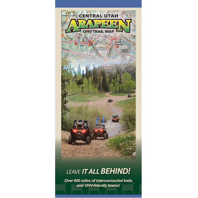
600+ miles of motorized trails and forest roads- Only 9.99
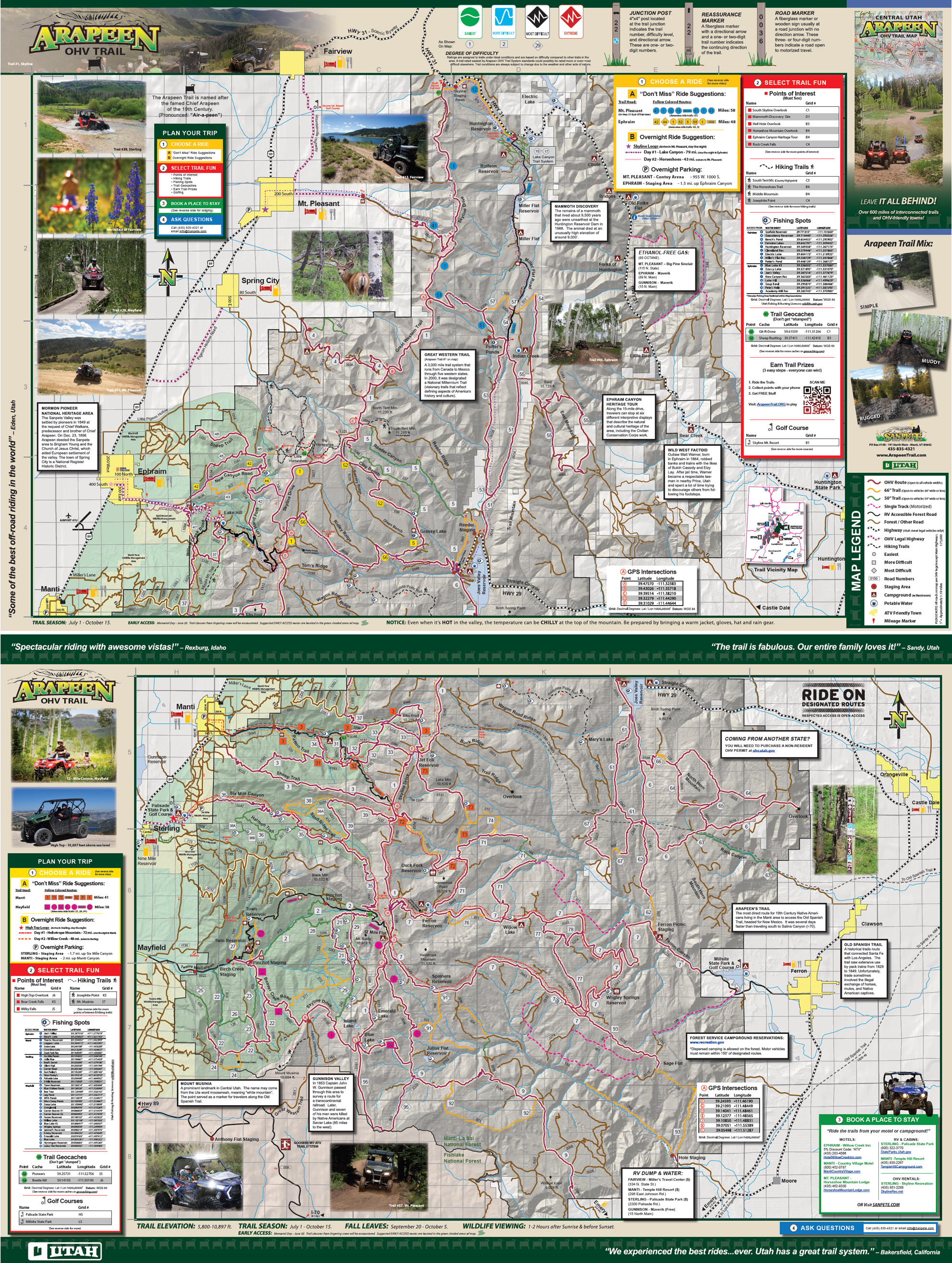
The paper map highlights trail-heads, suggested rides, points of interest, fishing spots, trail geocaches, campgrounds, and local towns. Everything you need to know for a GREAT ride! - While supplies last!
ORDER NOW BEFORE THEY ARE GONE- FREE SHIPPING!
If you are not satisfied, return within 15 days for a full refund.
If you are not satisfied, return within 15 days for a full refund.
|
Video Explanation of the Trail System & Map:
The Arapeen OHV Trail System has hundreds of miles of trails and forest roads available for motorized use. The Manti-La Sal National Forest is an extraordinary destination for Off Highway Vehicle (OHV) enthusiasts. Most of the routes are open to OHV of all sizes, however there are some 50", 66", and single track trails. It is a great place to ride Side by Sides, ATVs, and Dirt Bikes. The Arapeen Trail has riding areas for varying skill levels, from Easy to Difficult.
|
The map also includes a portion of the Great Western Trail. Nearby State Parks include: Palisade State Park, Millsite State Park, and Huntington State Park. The Arapeen Trail connects to the Gooseberry and Paiute ATV Trails to the South.
The Arapeen Trail Map is 36" x 24", folded size = 4" x 9". Printed on paper. If you have questions about the Arapeen Trail map, please contact me. - Kevin |