|
|
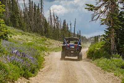
Side x Side heaven
|
The Famed Arapeen OHV Trail System.
|
|
Side x Side heaven
|

|
Everything you need to
plan a great ride: -Trail Maps -Ride Suggestions -Riding Season -OHV Laws -Trail Widths -Stay & Eat -Difficulty Level -Rentals “We had a blast riding in a wonderful OHV riding area. The beauty and challenging trails blew us away. You have a gem there”. -G. Biggs, San Diego, CA
|
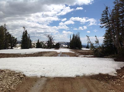
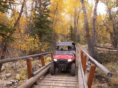
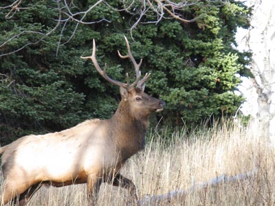
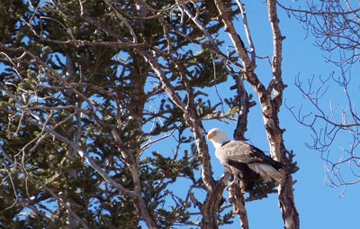
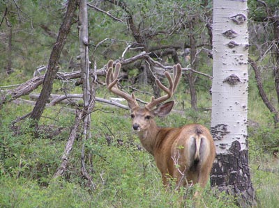
Why The arapeen trail?With over 600 miles of side-by-side friendly trails, sprawling across 350,000 acres of pristine National Forest, this adventure hub is an off-road enthusiasts' dream come true. As you explore this relaxing expanse, breathtaking Aspen and Conifer forests will surround you, and mountain lakes and awe-inspiring scenic vistas will amaze you. This hidden gem offers wildlife viewing, fishing, fresh mountain air, and an invigorating sense of freedom. Need equipment? No worries- rentals are available. Moreover, The Arapeen Trail is conveniently situated close to Salt Lake City but avoids crowds and commotion.
Best of all, the trail system is free to explore. So why not book a motel or campsite and ride straight to the trails? The Arapeen Trail is the perfect way to de-stress and enjoy all that nature has to offer. |
|
AT YOUR LEISURE Show
|
HOOKED ON UTAH Show (more shows)
|
Standard Map
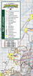
$9.00
Size: 11.75" x 16" Basic Paper Map, no frills |
Deluxe Trail Map Best Offer!
$9.99- Order Now!
"It costs less than a good Truck Wash!"
|
Economy Map
$2.00
Size: 10" x 13" Discount Paper Map |
|
In a hurry, buy map locally at:
Fairview: Big Pine Sports Mt. Pleasant: M.L.S. KOA Holiday Ephraim: Willow Creek Inn Manti: Country Village Motel Sterling: Palisade State Park -Mobile Phone Map: download now! Amazon.com w/ shipping $13.99
|
Watch video to learn about the Deluxe map
|
|
Are you tired of the same old crowded trails closer to the city? Look no further than the Utah Arapeen OHV Trail System, just two hours south of Salt Lake City on U.S. Highway 89. This extensive trail can be accessed from seven canyons in the Sanpete Valley, including the towns of Fairview, Ephraim, and Manti.
And the best part? All the trails and settlements are connected, allowing you to ride up one canyon, explore the “Skyline” at the top of the mountain, and descend down a different canyon to another town. Get lost in nature and enjoy the quiet serenity of this hidden gem. So pack up your OHV and hit the road for an adventure like no other. |
|
“I … have found this trail system to be one of the most beautiful rides I have been on. You can take short rides or go all day long. Connecting with towns that let you use city streets to access gas and goodies is very convenient.” -Linda, Riverton, UT
|
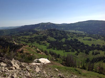
Experience the thrill of high-mountain adventure on the Arapeen Trail! Starting from the beautiful Sanpete Valley at 6,000’, this stunning trail climbs to an altitude of nearly 11,000’. The only catch? It's only open during summer, so plan your trip between July 1st and October 15th for the ultimate experience. With breathtaking views and plenty of adventure, this trail is not to be missed!
You can access the trail before July, however trail closures from lingering snow will be encountered. Suggested 'Early Access Routes' (Memorial Day - Jun 30th) are highlighted on the Arapeen Trail map. |
|
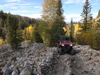
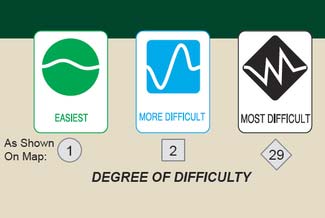
Not all trails on the Arapeen have the same Degree of Difficulty. With a range of trail options available, there's something for everyone. Take it easy on our beginner-friendly smooth forest roads, or challenge yourself with the rugged terrain of our advanced trails, complete with obstacles like rocks, ruts, mud, and fallen trees. Whether you're an experienced rider or just starting out, we invite you to LEAVE THE PAVEMENT BEHIND and explore the great outdoors on the Arapeen Trail System!
Our map not only shows the trail routes, but also gives an idea of the trail's difficulty level. The background shape of the route number indicates the level of difficulty: circles for easy, squares for more difficult, and diamonds for the most challenging trails. Keep an eye out for the sign posts along the way, which also show trail difficulty ratings. Remember, trail conditions are always changing and can shift with the next rainstorm! |
The fun begins where the pavement ends!
|
|
“We spent 5 days riding your trails, best time ever- great lodging, great food, coming back soon… two very happy couples.” -Larry, Victorville, CA
|
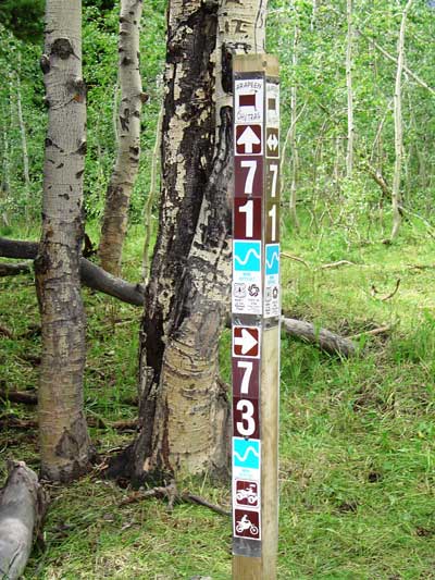
To help guide you through this massive trail system, Trail Marker Signs are strategically placed along the trails. These signs correspond with trail numbers on the map, making navigation a breeze.
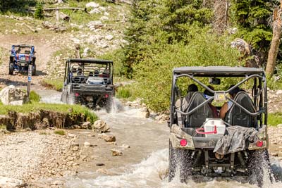
However, it's important to keep in mind that the Arapeen Trail can be quite remote and sprawling, so we recommend carrying a GPS unit or a mobile phone App to prevent getting lost. You'll be happy to know that most of our trails are open to vehicles of all sizes. We also have designated trails for 50" and 66" machines, totaling about 62 and 80 miles, respectively. To ensure the safety of all trail users, size gates are located at trail heads of narrower routes. And for those seeking an extra thrill, we offer limited single track trails for motorcycles. |

PO Box 148
191 North Main Manti, Utah 84642 |